Estimated time to cross the structure

The Honoré Mercier Bridge is co-managed by the provincial government (MTQ) and JCCBI.

Traffic flow indicators show the estimated time it takes to cross the structure. The zones highlighted in blue on the map are the responsibility of JCCBI. 

Honoré Mercier Bridge
Toward Montréal:
Toward South Shore:
No hindrance in progress

Planned hindrances

Sat
27 Jul
Sun
28 Jul
Mon
29 Jul
Tue
30 Jul
Wed
31 Jul
Thu
01 Aug
Fri
02 Aug
Sat
03 Aug
Sun
04 Aug
Mon
05 Aug
Tue
06 Aug
Wed
07 Aug
Thu
08 Aug
Fri
09 Aug
Honoré Mercier Bridge

Honoré Mercier Bridge

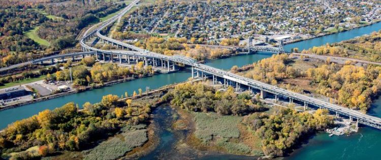
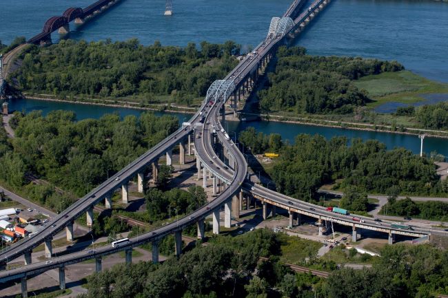
The Honoré Mercier Bridge, which is co-managed by the provincial government and JCCBI, serves as an example for collaboration with the Mohawk Council of Kahnawà:ke and the expertise of Mohawk contractors. The Bridge crosses the St. Lawrence River and the seaway, on the west side of the Island of Montreal.

Normal traffic lane configuration

Weekdays

Mornings from 5:30 a.m. to 9:30 a.m.

  • Continuously: one lane open from Châteauguay
  • Alternating (traffic lights): one lane open from Châteauguay or from La Prairie
  • Two lanes open towards the South Shore

Daytime, evenings, nights, and weekends 

  • Two lanes open towards the South Shore
  • Two lanes open towards Montreal (one from Châteauguay and one from La Prairie)

Traffic is managed by the provincial government.

Normal traffic lane configuration

JCCBI'S projects and sites

Massive structures like the Jacques Cartier Bridge or Bonaventure Expressway have many needs. They may require electrical repairs, paving, steel painting, and many other types of work. Most of these operations are planned in advance as part of JCCBI’s proactive asset management approach. Our Operations and Maintenance teams may also identify a need following an inspection or report, while user needs may change over time.   

JCCBI'S projects and sites
Go to top